Thunderstorms UK: where are yellow warnings for thunder and lightning in the UK this week, and what causes it?
and live on Freeview channel 276
After a spell of hot weather across the UK, much of the country will see thunderstorms in the coming days.
The Met Office has issued some weather warnings over the storms, which are set to develop over parts of the country during Wednesday night (June 16).
Advertisement
Hide AdAdvertisement
Hide AdIn parts of the country with the most severe weather, flooding and power cuts may occur.

What’s the forecast for this week?
On Wednesday, June 16, warm weather is expected to contiue in the southern half of the nation, with highs of up to 30C predicted in London, and 24C in Cardiff.
Northern Ireland and parts of central England will also see the warmer weather continue, the Met Office has predicted, with a chance that Wednesday could be the hottest day of the year.
The North West and parts of the North East, however, are expected to be much cooler, with showers over Scotland and Northern Ireland expected.

Advertisement
Hide AdAdvertisement
Hide AdThis warm weather will change for many over Wednesday night, with the Met Office predicting thunderstorms across many parts of the country.
Over Wednesday night, says the Met Office, “thunderstorms will more northwards across parts of England and Wales with heavy rain and lightning, these mainly across southern and central areas. Scotland and Northern Ireland clearer with a few showers.”
On Thursday June 17, there will be a “band of cloud and light rain across central and western areas. Risk of thunderstorms southeast of this. Mainly dry with sunny spells across much of Scotland and Northern Ireland.”
The outlook for Friday and Saturday is “mostly dry with sunny spells, although heavy, perhaps thundery, rain will affect much of England and parts of Wales on Friday. Rain and showers becoming more widespread again on Sunday.”

Where have weather warnings been issued?
Advertisement
Hide AdAdvertisement
Hide AdThe Met Office has issued yellow weather warnings for thunderstorms from 6pm on Wednesday until 6am on Friday.
The warnings cover areas south of Newcastle, but do not include the western edge of England and Wales, and Northern Ireland.
Long range forecast
From Sunday, June 20, to Tuesday, June 29, the Met Office is predicting “unsettled conditions” to start, with “rain and stronger winds in the northwest on Sunday.”
“Further south and east, it will generally be warm and humid, with a risk of thundery showers.
Advertisement
Hide AdAdvertisement
Hide Ad“Atlantic air is then likely to gradually spread in from the west across the country, bringing a change to cooler and more changeable conditions through the first half of next week,” said the Met Office.
“These conditions are likely to continue, bringing occasional spells of rain or showers interspersed with periods of dry weather and sunny spells.
“The driest and brightest conditions are likely in the southeast, though further showers or thunderstorms are possible here. Temperatures are likely to recover to near normal by the end of the month,” they predicted.
Further into the summer, the Met Office’s confidence is low, though they predict that “usual summertime conditions are probable.”
Advertisement
Hide AdAdvertisement
Hide AdRainfall is expected to be close to average for July, with thunderstorms again developing during warmer periods.
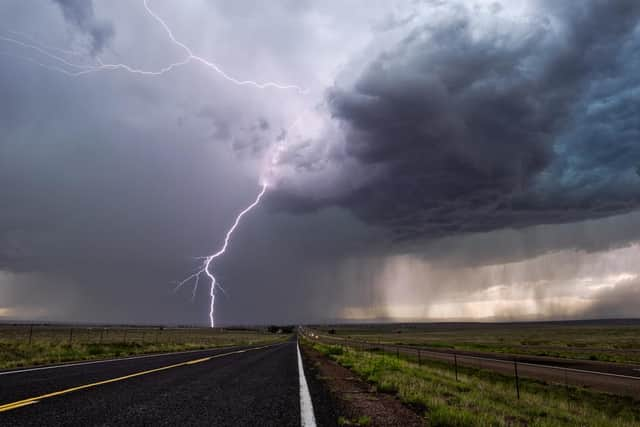
What causes thunder and lightning?
The Met Office explains that “thunderstorms develop when the atmosphere is unstable” and this occurs when “warm air exists underneath much colder air”.
As the warm air rises, it cools and condenses to create moisture and subsequently a cloud.
If the conditions are right, the cloud will build into a cumulonimbus cloud - the type needed to produce thunder and lightning.
Advertisement
Hide AdAdvertisement
Hide AdWithin a cumulonimbus cloud, there are updraughts and downdraughts of air.
The updraughts carry moisture and water droplets up so high that they freeze and turn into ice crystals. Once they become too heavy to be supported by the updraughts, they fall as hail.
The negative charged ice crystals are attracted to the positive charge, as well as to charges in nearby clouds and positive charges on the ground.
When this attraction is strong enough, the charges join together and discharge, creating flashes of lightning.
Advertisement
Hide AdAdvertisement
Hide Ad“Lightning is a large electrical spark caused by the negative charges moving from one place to another,” the Weather Channel explains.
Thunder occurs due to the quick expansion and heating of the air caused by lightning.
Comment Guidelines
National World encourages reader discussion on our stories. User feedback, insights and back-and-forth exchanges add a rich layer of context to reporting. Please review our Community Guidelines before commenting.