Snow forecast: Where will it snow? Met Office maps reveal UK areas set to experience snowfall in coming days

and live on Freeview channel 276
Areas of the UK have not quite had a reprieve from last week's cold snap, with temperatures plunging once again and snow now on its way.
Some places have already seen snow fall, while the thermometer dropped to -10C in the coldest areas on Monday January 15. Met Office yellow weather warnings for snow and ice are in place for most of Scotland, Northern Ireland and northern England, with some lasting through to Thursday January 18.
Advertisement
Hide AdAdvertisement
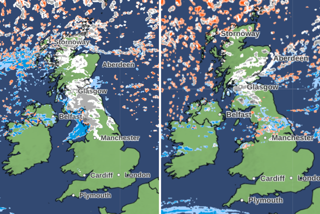
Hide AdHowever, new Met Office precipitation maps have shown just where the snow could fall on in the next few days. The forecast for Tuesday (January 16) into Wednesday (January 17) reads: "Outbreaks of sleet and snow will move across northern areas, with some heavy snow possible for a time, especially across parts of Scotland. Dry elsewhere with sunny spells, but for all areas it will be another very cold day.
"Frequent snow showers continuing in northern Scotland and Northern Ireland. Otherwise sleet and snow clearing northern areas leading to an ice risk. Clear skies elsewhere with a widespread severe frost.
"Snow showers feeding into coastal areas, mainly across Scotland. Elsewhere, many inland areas dry and sunny, though cloudier skies at first in south with odd wintry flurry possible."
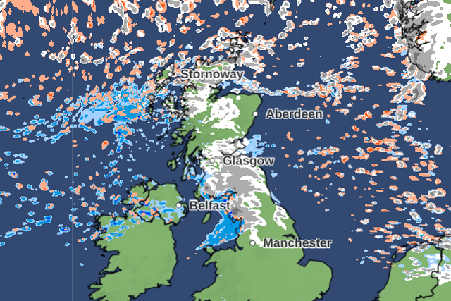

The map for 11am on Tuesday shows that the entire central belt of Scotland and the borders covered, with snow expected in this region. It also stretches down to the north-west of England and spreads across the Highlands and Islands of Scotland.
Advertisement
Hide AdAdvertisement
Hide AdThroughout the day it will move eastwards, with Newcastle upon Tyne likely to be hit at around 1pm onwards. Snow is set to subside for most of the country, except from smatterings in northern Scotland, but will make a return from 7pm again.
The central belt is again likely to see snow falling, with Glasgow, Edinburgh and Dundee among the places set to be hit. Again this will move south-easterly, with snowfall again likely to hit Newcastle at around midnight.
Into Wednesday, snow is forecast to mainly only affect northern Scotland, with some small smatterings across the north of Northern Ireland. This will continue into Thursday also.
Comment Guidelines
National World encourages reader discussion on our stories. User feedback, insights and back-and-forth exchanges add a rich layer of context to reporting. Please review our Community Guidelines before commenting.