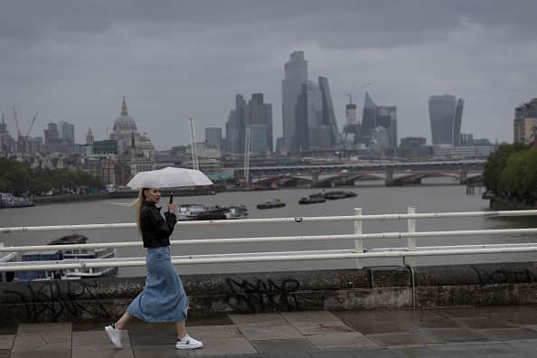
UK weather: Heatwave reprieve until mid-August as rain set to batter country for school holidays - Met Office
and live on Freeview channel 276
While some parts of Europe have been experiencing an unrelenting heatwave in recent days with temperatures well above 40C, the UK will not experience any scorching summer weather until at least mid-August, according to the Met Office.
Showers are expected to hit the country throughout the week, although the heavy winds that were reported across the country over the weekend are expected to calm down on Monday (July 17). On Tuesday, heavy rain is expected across central and northern parts of England, Wales and Northern Ireland, with temperatures not rising above 20C.
Advertisement
Hide AdAdvertisement
Hide AdHowever, later in the week, the country will experience some bright intervals, despite showers, which will last into Friday, merging into lengthier spells of rain at times, with temperatures remaining at or just below average.
Meteorologist Simon Partridge said: “The general gist is it will become a little more settled through the week but we are not going to see weather as wet and windy as over the weekend, but at the same time there will not be any particular dry or settled or warm weather either, so things are carrying on for July as they have for the past couple of weeks.
“As we go through Monday, it will be another day of sunshine and showers. The good news is that winds will be lighter than over the weekend as that low pressure moves a bit further away and also the showers will be fewer and farther between but still the risk of a thundery shower across eastern parts through the afternoon.
“In terms of temperatures through the week, they are bizarrely similar, they are around average for the time of year, many places in high teens and the further south and east you are, you are looking at low 20s with 22C or 23C.
Advertisement
Hide AdAdvertisement
Hide Ad“The day with the most significant weather is Tuesday, we have an area of low pressure that moves across the UK which will bring some quite heavy rain at times, particularly across central and northern parts of England, Wales and Northern Ireland, with north and south of that a reasonably dry day.”
The Met Office forecaster predicted that the pattern of changeable weather would continue in the coming days, adding: “It’s fairly disappointing for the middle of July, nothing particularly warm or sunny.


“At the moment, the main signal on our long-range models is there is a signal for things turning drier and warmer but not until mid-August.
“The weather pattern is blocked and not changing which is part of the reason why things got so warm in southern Europe, because that high pressure is just sitting there, keeping that warmth growing, but unfortunately it is keeping us in this more changeable airstream, so nothing too wonderful for the next couple of weeks.”
Advertisement
Hide AdAdvertisement
Hide AdSome parts of Europe saw dangerous levels of heat over the weekend as the Cerberus heatwave continued to grip the south of the continent. In Italy, temperatures continued to swelter with a second heatwave rocketed 12C above average in some areas on Sunday (July 17).


UK 5-day forecast
Monday (July 17)
A mixture of sunshine and showers throughout today. These may be heavy in places with a risk of an isolated thunderstorm. Breezy especially around showers but lighter winds than over the weekend so feeling slightly warmer.
Overnight, showers easing to leave some late sunny spells. Clouding over into the early hours for western areas with outbreaks of rain. Cool under clear skies for central and eastern parts.
Tuesday (July 18)
An area of rain will spread northeastwards, this turning heavy in places. Remaining mostly dry and feeling warm in the southeast. Winds generally light though breezy in the west.
Outlook for Wednesday (July 19) to Friday (July 21)
Brighter into Wednesday and Thursday with sunny spells and showers. Showers continuing into Friday, merging into longer spells of rain at times. Temperatures at or just below average.
Comment Guidelines
National World encourages reader discussion on our stories. User feedback, insights and back-and-forth exchanges add a rich layer of context to reporting. Please review our Community Guidelines before commenting.
