UK weather: Will there be thunder this weekend? Will it rain and will there be another heatwave?
and live on Freeview channel 276
Much of the UK could see thunderstorms this weekend, before autumn weather arrives next week, the Met Office has said.
But some areas, particularly in the south, could get a final blast of summer heat if they avoid the showers as temperatures remain high.
Advertisement
Hide AdAdvertisement
Hide AdNational severe weather warnings are possible as humid air moves northwards, bringing the risk of thunderstorms, the Met Office warned.
Met Office meteorologist Ellie Glaisyer said: “On Sunday there will be widespread thunderstorms, but it will start to get drier as the day goes on.
“We could see temperatures reach 24C in the south. In Scotland the temperatures will remain in the mid teens.”
Almost a month’s rain could fall on parts of the UK on Sunday, the Met Office has said.
Advertisement
Hide AdAdvertisement
Hide Ad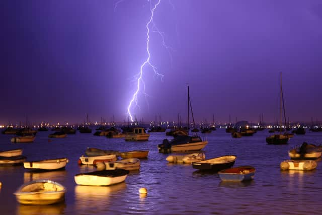

The forecasting body warned of a “small chance” lives could be put at risk in thunderstorms which are expected to hit the south west of England and south Wales.
It has issued a yellow weather warning for thunderstorms across the region between 7am and 6pm, covering major cities including Bristol, Cardiff and Swansea.
Homes and businesses could also be in danger of flooding quickly in “torrential downpours”, although the risk is said to be low, as up to 70mm of rain falls in a few hours in some spots.
The September average rainfall for the region is 92.45mm.
Buildings could also be damaged by lightning, hail or strong winds as well as floodwater.
Advertisement
Hide AdAdvertisement
Hide AdThere is also a “small chance” of power cuts or that other services to homes and businesses could be lost while some communities could also be cut off by floodwater, the forecaster said.
People planning on travelling face the prospect of delays or sudden cancellations to trains and busses.
Roads may be closed at short notice due to spray and sudden floods and “difficult driving conditions” are expected on those that remain open.
Met Office meteorologist Rachel Ayers said the region has already seen some rain fall but it is expected to get worse later this weekend.
Advertisement
Hide AdAdvertisement
Hide AdShe added: “The heaviest and most persistent rain will be tomorrow morning, bringing a risk of some potential flooding in homes and businesses.”
Ms Ayers urged drivers to think about their stopping distances if they need to travel on a motorway and to look at the Met Office and RAC websites for updates before setting off.
More heavy showers and even further thunderstorms are possible in the region early next week while the band of rain is set to move northwards.
Much of England and Wales will remain unaffected by the storms but lighter rain could fall across the north of England, Northern Ireland and the west of Scotland over the weekend.
Advertisement
Hide AdAdvertisement
Hide AdCloudy conditions are expected in unaffected areas, with a possibility of sunny spells that are “likely to be fairly limited”, while temperatures are not set to top the low 20s.
Unsettled weather on Monday and into next week will see temperatures return to the average for the time of year, and it will “start to feel fresher, and much more autumnal”.
Comment Guidelines
National World encourages reader discussion on our stories. User feedback, insights and back-and-forth exchanges add a rich layer of context to reporting. Please review our Community Guidelines before commenting.