El Niño and La Niña: meaning behind natural climate phenomena - will it cause a record-breaking summer?

and live on Freeview channel 276
El Niño and La Niña are the names of climate patterns which can cause big fluctuations in the Earth's climate system, and their behaviour can have consequences that impact the globe. According to the US science agency National Oceanic and Atmospheric Administration (NOAA), the world has already officially entered an El Niño phase.
With the Earth’s climate changing, and the consequences of global warming more apparent, it is vital for researchers to monitor this natural phenomenon to understand the impact it will have globally. This weather cycle has officially formed in the Pacific Ocean, and may add more heat to an already warming planet. In 2016 a strong El Niño led to record global warmth, and with climate change, it could make 2023 or 2024 even hotter.
Advertisement
Hide AdAdvertisement
Hide AdSo what are El Niño and La Niña, what do they tell us about the Pacific Ocean and how were they discovered? Here is what you need to know.

What is El Niño?
Literally meaning ‘The Boy’ in Spanish, the term is used for the warm phase of the El Niño-Southern Oscillation (ENSO) - the irregular periodic variation in winds and sea surface temperatures over the tropical eastern Pacific Ocean. It is accompanied with high air pressure in the western Pacific but low air pressure in the east.
The phases are known to last close to four years, and often peak in December. This is where the name originated from, as ‘the boy’ is thought to have originated from ‘El Niño de Navidad’ when it was discovered by Peruvian fishermen, who named it after Christ as a child. El Niño is declared when, on the long-term average, temperatures in the tropical eastern Pacific rise by 0.5C.
El Niño events happen irregularly at two-to-seven year intervals, and are not predictable.
Advertisement
Hide AdAdvertisement
Hide AdWhat is La Niña?
La Niña, or ‘the girl’ is the opposite side of the natural phenomenon and is the cool side of the ENSO. It sees the average sea temperature cooler - usually by 3C to 5C below average. La Niña appears for longer than five months and occurs every few years as a result of temperature fluctuations in the oceans' temperatures around the equatorial band of the Pacific. It is believed La Niña occurs as strong winds blow warm water at the ocean’s surface away from South America, towards Indonesia. As the warm water moves west, the cold water from the deep sea rises to the surface and creates La Niña.
How do El Niño and La Niña impact the climate?
El Niño
As the seawater warms, there is a shift in the atmospheric circulation, and rainfall becomes reduced over Indonesia, India and northern Australia. Over the tropical Pacific Ocean, rainfall and tropical cyclone formation increase. The phenomena disrupts the global climate and normal weather patterns, which can lead to intense storms and droughts. The events of 1982-83 and 1997-98 were the most intense of the 20th century. During the 1982-83 event, sea-surface temperatures in the eastern tropical Pacific were 7.8 to 12.8C above normal.
According to the Natural Geographic, this led to severe climatic changes: Australia experienced harsh drought conditions; typhoons occurred in Tahiti; and record rainfall and flooding hit central Chile. The west coast of North America was unusually stormy during the winter season, and fish catches were dramatically reduced from Chile to the US state of Alaska.
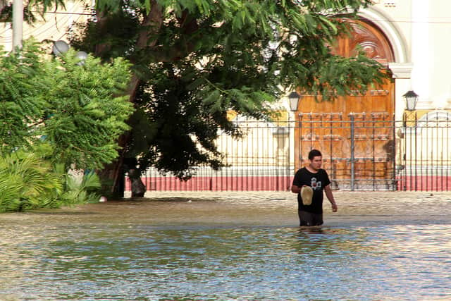
The 1997-98 event produced drought conditions in Indonesia, Malaysia, and the Philippines. Peru experienced very heavy rains and severe flooding. In the United States, increased winter rainfall hit California, while the Midwest experienced record-breaking warm temperatures during a period known as “the year without a winter.”
La Niña
Advertisement
Hide AdAdvertisement
Hide AdDuring a La Niña year, cold waters in the Pacific push the jet stream northward which can lead to drought in the Southern US and heavy rainfall in the Pacific Northwest and Canada.
Winter temperatures are warmer than normal in the South and cooler in the North, which can lead to a more severe hurricane season.
Comment Guidelines
National World encourages reader discussion on our stories. User feedback, insights and back-and-forth exchanges add a rich layer of context to reporting. Please review our Community Guidelines before commenting.