Met Office cold weather alert: what do Level 3 alerts mean, where in UK will be hit, how cold will it get?

and live on Freeview channel 276
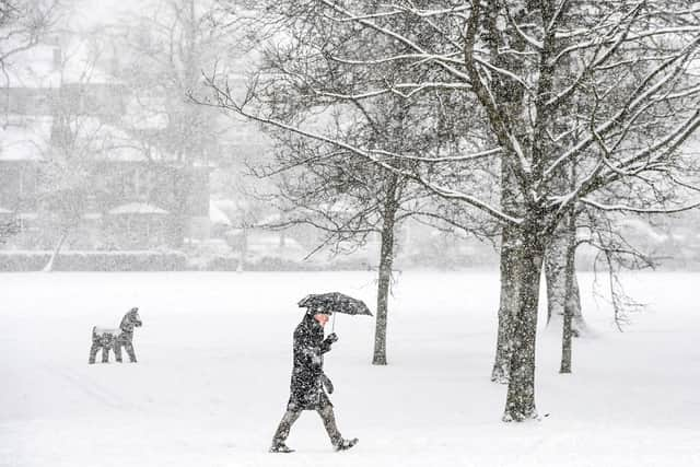
The UK is being told to brace itself for “severe cold weather and icy conditions”. The Met Office has issued a level 3 alert for cold weather in England, with a yellow weather warning for snow and ice issued for Scotland until Sunday.
Temperatures have been predicted to drop as low as -10C. The Met Office expect the cold weather will continue through the weekend into next week with “an ongoing chance of wintry showers, mainly for coasts, and freezing fog patches inland.”
Advertisement
Hide AdAdvertisement
Hide AdA fuel poverty charity has warned that people have been left struggling to heat their homes due to “impossibly high prices” and face “dreadful consequences” due to the low temperatures.
People are being urged to look out for vulnerable friends and family and to ensure they heat their homes to 18C and wear “several layers of clothing” to stay warm.
Here’s everything you need to know about the Met Office cold weather alert and what it means for you.
What does a level 3 alert mean?
The Met Office issues cold weather alerts in England during the winter months from November 1 to March 31 in association with the UK Health Security Agency (UKHSA). They give members of the public an advanced warning of weather conditions that could significantly impact your health and well-being.

Advertisement
Hide AdAdvertisement
Hide AdThe level 3 cold weather alert is described as “Severe” and one step below a “Major incident”. It predicts temperatures will drop to 2C or less and the possibility of widespread ice and heavy snow. Social and healthcare services will take specific actions to help protect high-risk groups.
To keep well and stay safe during a level 3 cold weather alert the Met Office recommends you:
- Stay tuned into the UK forecast.
- Check daytime room temperature and maintain it at 18 °C (70 °F).
- Check bedroom night-time temperature and maintain it at 18 °C (65 °F) or warmer.
- If you have to go out make sure you dress warmly and wear non-slip shoes. Also tell someone where you are going and let them know when you get back. If you have a mobile phone keep it charged and on you at all times.
- Keep active.
- Dress warmly, eat warm food and take warm drinks regularly.
- Check on those you know are at risk.
- If you are concerned about your own health or welfare or that of others, alert emergency services.
- Clear pavements of ice or snow if you are able and if essential.
Where will the alert be in the UK?
A Level 3 Cold Weather Alert has been issued covering all of England from Wednesday (7 December) evening until Monday 12 December.
There are concerns about the impact the cold weather will have on vulnerable people. Dr Agostinho Sousa, Consultant in Public Health Medicine at UKHSA, explained: “Cold weather can have serious consequences for health, and older people and those with heart or lung conditions can be particularly at risk.”
Advertisement
Hide AdAdvertisement
Hide AdDr Sousa added: “If you have a pre-existing medical condition, you should heat your home to a temperature that is comfortable for you. In rooms you mostly use such as the living room or bedroom, try to heat them to at least 18°C if you can. Keep your bedroom windows closed at night. Wearing several layers of clothing will keep you warmer than one thicker layer.”
How cold will it get?
The Met Office have predicted it could get to “-10C” in some areas by the end of the week, with sleet, snow and ice possible along the east coast and widespread hard frosts and patchy freezing fog inland.
Met Office Deputy Chief Meteorologist, Jason Kelly explained: “Through the weekend and into next week cold weather will continue, with an ongoing chance of wintry showers, mainly for coasts, and freezing fog patches inland.
“An area of low pressure may then threaten southern and southwestern parts of the UK through mid-week. Confidence in the exact track of this system is low, but should it push precipitation into the UK, then this would readily turn to snow, with a lower chance of freezing rain. How far north the milder air gets is also open to a lot of uncertainty, but for now, many central and northern areas are likely to remain in the Arctic airmass.”
Advertisement
Hide AdAdvertisement
Hide AdPeople are being urged to look out for vulnerable friends and family and to ensure their indoor home temperature reaches at least 18C.

Will it snow?
The Met Office have predicted that it will snow in the UK this week, with a yellow weather warning issued in Scotland advising people that “disruption is likely”. They have also advised snow could affect “parts of Northern Ireland and north east England.”
They have also revealed that snow could possibly affect areas in southern England telling PA Media: “Our forecasters are looking at the possibility of snow affecting the south east of England on Sunday night and into Monday morning. If this happens it could bring some disruption to Monday’s rush hour.”
Why is it going to get so cold?
The Met Office have reported the cause of the cold weather to be an “arctic maritime air mass”. Met Office Deputy Chief Meteorologist, Rebekah Sherwin, explained: “Temperatures will start to dip this week, with daytime temperatures struggling to get above freezing in many places from mid-week onwards. However, the cold air from the Arctic will also bring brighter conditions, with some dry, sunny spells in many areas, particularly away from the coast.”
Advertisement
Hide AdAdvertisement
Hide AdSherwin added: “Showers will turn more wintry as the week goes on with a risk of snow at times. A yellow National Severe Weather Warning for snow has been issued for Wednesday covering northern Scotland. We can expect to see some snow and wintry showers further south as the week progresses, particularly in coastal areas or over higher ground. There will be widespread frosts with temperatures falling to as low as -10°C overnight in isolated spots by the end of the week.”
Comment Guidelines
National World encourages reader discussion on our stories. User feedback, insights and back-and-forth exchanges add a rich layer of context to reporting. Please review our Community Guidelines before commenting.