Snow forecast: Coldest January temperatures in 14 years as low as -15C could hit UK tonight, Met Office warns

and live on Freeview channel 276
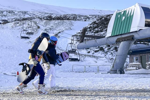
The coldest January temperatures in 14 years could hit the UK tonight, the Met Office has said. The national forecasters said snow-covered parts of Scotland could reach as low as -15C on Tuesday night (January 16) as freezing temperatures and snow continue for much of Britain this week due to a cold Arctic blast.
More than 100 schools were closed in Scotland on Tuesday, while drivers faced difficult conditions thanks to the wintry weather across north-west England, including in Merseyside, Cheshire and Cumbria. Yellow weather warnings for snow and ice are in place across Scotland, much of northern England and parts of North Wales until Thursday, then milder temperatures are forecast along with wind and rain.
Advertisement
Hide AdAdvertisement
Hide AdThe Met Office said a “cold plunge of Arctic air” has moved south across the whole country over the past few days, making it 5C to 6C lower than usual for this time of year, with temperatures dropping as low as -15C in places on Tuesday night.
More than 40cm of snow could be seen on high ground in north-west Scotland by the end of Friday as it continues to build up over the coming days, the Met Office added. Meanwhile, lower ground in north-west Scotland could see between five and 10cm of snow by the end of the working week.
There is also a chance of a few centimetres of snow falling on the extreme south of England this week, but this remains to be seen as the Met Office reviews the situation. However, the white stuff isn't going to stick around for long, said the Met Office, as the weekend will be milder, which will bring wind and rain that potentially will result in more weather warnings as the snow melts.

Stephen Dixon, spokesperson for the Met Office, said: “We’ve seen a fair bit of snow already and more is expected in coastal areas, the north of Scotland, north-west England and south-west Scotland. It will be a continuing theme through much of this week.”
Advertisement
Hide AdAdvertisement
Hide AdHe added: “Towards the weekend it’s looking like we will return to a more western influence, so wet and windy as you get to Friday and it will bring temperatures up slightly. As you get towards Saturday you could see maximum temperatures of 11C in the south west of England which is much milder than what we’ve seen as of late.
“By Sunday we would see quite a deep area of low pressure moving in which will bring strong winds and heavy rain. The additional hazards will be snow melting and rainfall on Sunday.”
The UK Health Security Agency has issued a cold-health alert, which warns of possible impacts for the health and social care sector, while National Highways has put in place a severe weather alert for snow affecting north-west England on Tuesday, with road users advised to plan ahead and some rural communities warned they could be temporarily cut off.
Amy Fellows, national network manager at National Highways, said: “Freezing conditions bring so many hazards such as snow and ice, so take every possible step to understand your journey in advance and allow lots of extra time when travelling, to prepare for the unexpected.”
Advertisement
Hide AdAdvertisement
Hide AdNational Rail has warned the wintry weather could affect train journeys all week, with ScotRail saying services on the Highland Mainline route on Tuesday would be delayed by around 30 minutes.
Met Office chief meteorologist Andy Page said: “There will be widespread frost this week and we could see some fairly deep laying snow in parts of northern UK and strong winds could result in drifting or blizzard conditions at times. The snow and ice will be disruptive and could potentially impact travel plans, making driving dangerous and pavements slippery.”
Comment Guidelines
National World encourages reader discussion on our stories. User feedback, insights and back-and-forth exchanges add a rich layer of context to reporting. Please review our Community Guidelines before commenting.