UK thunderstorms forecast: Eight flood alerts issued after Met Office yellow weather warning

and live on Freeview channel 276
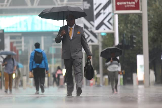
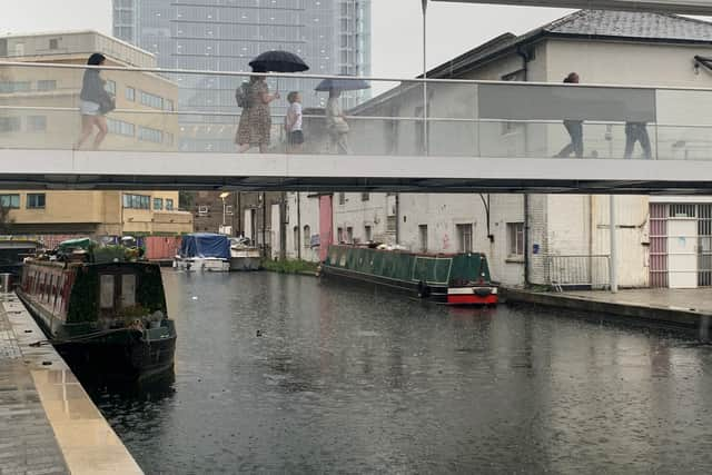
Eight different flood alerts have been issued by the Environment Agency, following the Met Office’s yellow weather warning for rain.
These warnings are released where “flooding is possible”, and include a large swathe of south London.
Advertisement
Hide AdAdvertisement
Hide AdThe following boroughs have been issued with flood alerts: Merton, Sutton, Kingston upon Thames, Richmond upon Thames, Wandsworth, Lewisham, Bromley, Greenwich and Croydon.
The flood warning for Upper River Wey, in the south east, has been removed.
The warning comes after a period of dry weather which has seen drought declared across swathes of England, with parched grass and struggling crops, streams drying up and river, reservoir and aquifer levels low, and hosepipe bans brought in for millions as heatwaves pushed up demand for water.
Where has flooding hit the UK?
In east London, Dagenham Heathway station was closed on Thursday morning due to flooding caused by heavy rain, while a number of exits were closed at Charing Cross station in central London.
Advertisement
Hide AdAdvertisement
Hide AdThe Met Office has warned of difficult driving conditions and some road closures due to spray and standing water.
Train delays and potential loss of power and other services are also likely.
As of Wednesday (24 August 2022), the UK had only 46% of the average total rainfall for August.

What is the expected weather over the next few days?
Heavy thundery rain in the south east is easing, with sunny spells across the rest of the UK.
Advertisement
Hide AdAdvertisement
Hide AdA tweet from the Met Office shows will appear across Southeast England, with risk of heavy rain still apparent.
Tonight is more clear, as it’s dry with clear spells across central and eastern parts and cooler than of late. Cloud and showery rain in the northwest extending to other western parts by morning.
On Friday (26 August) clouds and outbreaks of rain are predicted to affect many western parts and will be replaced by showers by afternoon with some brightness developing. Elsewhere, including northwest Scotland, it will be mostly dry and fine.
The bank holiday is expected to be largely dry with warm sunny spells, though possibly wetter in the North West.
Advertisement
Hide AdAdvertisement
Hide AdTemperatures could climb to 30C or into the mid-20s depending on how the high pressure builds, the Met Office said.
What has been said about the weather?
Spokesman Grahame Madge said: “We’ve definitely switched from the hot and dry regime to something that has rain in the forecast.”
While the downpours will mean this month will “catch up a bit” with rainfall totals, he said: “It’s certainly going to be a dry August for the whole of the UK.”
He said some areas had gone without any significant rainfall from the middle of June until last week.
Advertisement
Hide AdAdvertisement
Hide Ad“We’ve had below average rainfall for such a long time, it’s going to take a period of above average rain to make it up”.
Annie Shuttleworth, a meteorologist at the Met Office, said: “We have seen a band of quite heavy and thundery rain push across central and south-eastern parts of England, and it’s going to continue to push into East Anglia through the rest of today.
“Overnight, Andrewsfield received 56mm of rain in three hours, and in six hours, 61.4mm of rain.
“The average rainfall for August for an area in southern England is 67.8mm, so it’s not greater than that but it’s close – so it was a significant amount of rainfall.”
What does this weather mean in terms of climate change?
Advertisement
Hide AdAdvertisement
Hide AdRainfall is determined by how warm the air is, and the movement of water patterns across the world.
Hotter air holds more moisture, and for every 1C more the air warms, clouds can hold about 7% more water, which in return creates heavier rain.
Heavier rain leads to a greater risk of flash flooding. Scientists warn that climate change is making weather extremes more likely, increasing heatwaves, droughts and heavy rain events that can lead to flash floods.
The Environmental Agency has published The National Flood Resilience Review, which looks at a combination of short-term and long-term projects to mitigate flooding based on different futures under climate change.
Comment Guidelines
National World encourages reader discussion on our stories. User feedback, insights and back-and-forth exchanges add a rich layer of context to reporting. Please review our Community Guidelines before commenting.