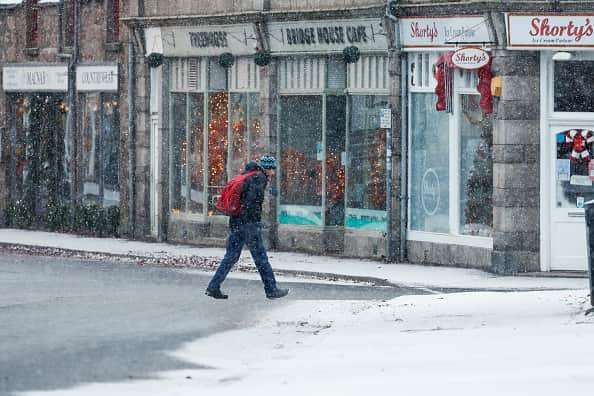
UK weather: Cold snap persists with more snow set to arrive amid freezing temperatures - forecast
and live on Freeview channel 276
More snow is set to make its way to some parts of the UK in the coming days, with temperatures dropping to single digits during the day and sinking into below-freezing temperatures at night as the cold snap continues, the Met Office said.
The forecasters said the UK is expected to experience a continued flow of cold air from the northeast, maintaining chilly conditions into the upcoming week. Although many areas will see dry and sunny weather, there's a chance of showers, especially along the eastern coasts, which could turn wintry at times.
Advertisement
Hide AdAdvertisement
Hide AdHowever, southern and central regions are likely to become less cold and more unsettled next week while the north remains cold with additional wintry coastal showers. This comes after the UK Health Security Agency (UKHSA) has issued cold-health alerts (yellow and amber) for all regions in England, extending until December 5.
Met Office Chief Meteorologist, Frank Saunders, said: “Snow has already settled in parts of eastern Scotland and over higher ground in northeastern England. Areas such as Dartmoor and Bodmin Moor in the southwest have also seen rain turning to snow and accumulating as it bumps into the cold air covering the UK; some sleet and snow is falling to lower levels too but mostly not settling.
“Snow showers are expected to continue today (Thursday, November 30), with the potential for further accumulations over higher ground. Where the showers fall as rain there is a risk of icy patches forming overnight with temperatures widely dipping below freezing. A number of National Severe Weather Warnings have been issued and these are likely to be updated over the coming days, so stay up to date with the forecast for your area.”
While some may be hoping for some white stuff on their doorsteps, the Met Office explained that snowfall in late autumn or early winter tends not to persist because during this time, ground temperatures generally remain relatively high, making it less conducive to retaining snow.
UK 5-day weather forecast
Thursday (November 30)
Advertisement
Hide AdAdvertisement
Hide AdMany places dry with clear spells and a widespread frost developing. Wintry showers becoming confined near to North Sea coasts and parts of Northern Ireland. Freezing fog patches developing for parts of England and Wales.
Friday (December 1)
Staying cold Friday, with sunny spells and some wintry showers, mainly towards coastal areas. Becoming cold again into the evening with a widespread overnight frost and freezing fog patches likely.


Outlook for Saturday (December 2) to Monday (December 4)
Cold and dry Saturday with further wintry showers, but these easing. Turning cloudier and warmer from the southwest with rain spreading north later on Sunday and into the new week.
Comment Guidelines
National World encourages reader discussion on our stories. User feedback, insights and back-and-forth exchanges add a rich layer of context to reporting. Please review our Community Guidelines before commenting.
