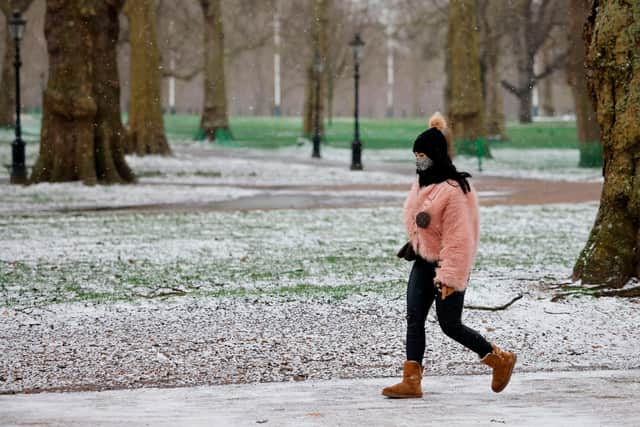
Why is it so cold today? How common snow and hail are in May - and when the weather will get warmer in 2021
This article contains affiliate links. We may earn a small commission on items purchased through this article, but that does not affect our editorial judgement.
and live on Freeview channel 276
Chilly temperatures are forecast across the UK this week, with sub zero temperatures expected in some northerly parts.
The unusually cold spring weather brought heavy gales, showers and icy hail to many parts of the country over the May Bank Holiday weekend, and the forecast is not looking much better for the rest of the week.
Advertisement
Hide AdAdvertisement
Hide AdWhat is the forecast for this week?


A yellow weather warning has been issued for Scotland on Thursday (6 May), from 3.45pm to 11pm.
The Met Office has warned that snow and rain will travel southwards from the Highlands and Grampian, to reach the Central Belt by dawn.
The weather will turn more showery by mid to late morning, with snow levels becoming more confined to the highest roads, and may accumulate up to 6cm deep.
As for other parts of the UK, cold temperatures and rain is expected in northerly parts, interspersed with some sunny intervals, while further south, scattered showers are forecast throughout the day.
Advertisement
Hide AdAdvertisement
Hide AdFriday (7 May) will have a chilly start, with a mix of sunshine and showers, which could turn heavy with a risk of hail and thunder in the northeast.
Spells of rain and strong winds are on the cards over the weekend, heading northeast through Saturday (8 May), with showers becoming more widespread by Monday (10 May).
Temperatures will become closer to the seasonal average, with the southeast expected to be briefly warm.
Is snow and hail normal in May?
It is not uncommon for spring in the UK to see big swings in temperature, according to the Met Office.
Advertisement
Hide AdAdvertisement
Hide AdSpring temperatures are largely influenced by latitude, with northern parts of the UK, particularly Scotland, experiencing much cooler temperatures than the lower latitudes, which is why southern parts of the UK are typically warmer.
While spring in the UK is usually quite calm and dry due to the Atlantic losing heat during autumn and winter, causing less heat and moisture to be transferred into the atmosphere, it is not unusual for temperatures to drop to low levels.
On average, temperatures will fall to 0°C or below on around 14 days each spring, and even central and southeastern England can expect to see temperatures drop to this level for around 10 days during the season.
Coastal regions and islands around the south of the UK typically have the fewest spring frosts on average, with these chiller climes usually occurring at the beginning of and the end of the season.
The average temperature for May is around 16C in England.
Advertisement
Hide AdAdvertisement
Hide AdDr Mark McCarthy, Scientific Manager of the National Climate Information Centre, said: “It’s not unusual to experience a wide temperature variation during a typical spring.”
“Of course, you would expect the lowest and highest spring temperatures to occur at the beginning and end of the season respectively, but natural variation dictates that periods of lower than average temperatures are to be expected as we move through the season.”
When will the weather warm up?
The unsettled weather is expected to last into next week, bringing spells of locally heavy rain across the northwest, while the rest of the UK will see a mixture of sunshine and scattered showers on Monday (10 May).
Heavy downpours, with risks of hail and thunderstorms in the west, are expected early in the week, along with strong gales across much of the country.
Advertisement
Hide AdAdvertisement
Hide AdTemperatures will be nearer to the average, although will still feel a little chilly in the far north at the beginning of the week.
From Wednesday (13 May) onwards, a combination of sunshine and showers is likely, with areas in the south forecast to see the most settled and dry conditions.
Towards the north and northwest there is an increased chance of unsettled weather, bring longer spells of rain and strong winds from the Atlantic, but temperatures are likely to be around average.
A message from the editor:
Thank you for reading. NationalWorld is a new national news brand, produced by a team of journalists, editors, video producers and designers who live and work across the UK. Find out more about who’s who in the team, and our editorial values. We want to start a community among our readers, so please follow us on Facebook, Twitter and Instagram, and keep the conversation going.