
Greenland on World map: Where is it located, is it a country, population, language - is it bigger than Australia?

Greenland is the world's largest island and an autonomous Danish dependent territory with self-government and its own parliament.
Denmark contributes two-thirds of Greenland's budget revenue, the rest coming mainly from fishing. Potential oil, gas and rare earth mineral reserves have attracted prospecting firms.
Greenland enjoys perpetual daylight for two months each year. Over 80% of the island is covered by a permanent ice cap 4km thick in places. The US has long seen Greenland as strategically important and established a radar base at Thule during the Cold War. With the melting of the ice around Greenland, the possibility of new trade routes opening has increased the Arctic's importance.
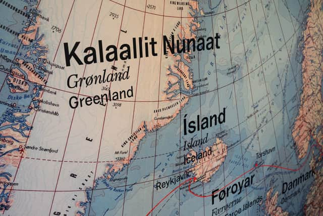
Greenland’s capital is Nuuk and the country has a population of 57,000. Languages spoken are Greenlandic, Danish and English. It is located between the Arctic Ocean and the North Atlantic Ocean, northeast of Canada and northwest of Iceland.

There are no daily newspapers in Greenland. The major titles - a weekly and a bi-weekly - publish in Greenlandic and Danish.
Seeing that 80% of Greenland is covered by ice, the Greenlanders live along the coasts. The ice-free areas are about 410,500 square kilometers. This corresponds to the size of Norway.
Greenlands capital, Nuuk, is located in West Greenland and is by far the largest town with its 16,500 residents. The other major towns are Sisimiut, Ilulissat and Qaqortoq. The second largest town is Sisimiut with about 5,500 inhabitants. The rest of the towns have between 1,000 to 4,500 inhabitants.
The currency used is Danish kroner. There have been Greenlandic banknotes and coins with the same value as the Danish kroner but production of these stopped in the late 1960s.
Greenland is not bigger than Australia, but it is bigger than several European countries combined like France, Germany, Spain, UK, Italy. It's roughly the size of Alaska and Texas combined.