
After weeks of intense earthquake activity in an area of Iceland, a volcano has erupted which can be seen from the country's capital Reykjavik. The eruption has taken place only 2.5 miles north-east of the town of Grindavik which was earlier evacuated last month due to seismic activity.
According to the Icelandic Met Office, the volcanic eruption started at 22:17 local time (22:17 GMT). Experts do not think the unfolding events will not bring the same level of disruption as what was felt back in 2010 due to the Eyjafjallajökul eruptions causing an ash cloud over much of western Europe. The volcano, located on the Reyjanes peninsula just south of Reykjavik, erupted after weeks of anticipation following an uptick in earthquake activity in the area. Icelandic authorities declared a state of emergency in November and the possibility of volcanic eruption was put on high alert. The fishing town of Grindavik was evacuated again over recent days, with residents having previously been moved away over fears that the lava may pose a risk to the town. The Icelandic Met Office said: "Seismic activity together with measurements from GPS devices indicate that the magma is moving to the southwest and the eruption may continue in the direction of Grindavik."
NatinalWorld has compiled images to show the impact that earthquakes and volcanic eruptions have had in southwest Iceland during 2023.
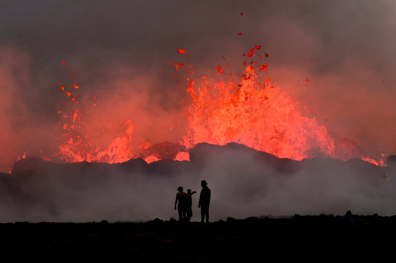
1. People watch flowing lava during an volcanic eruption near Litli Hrutur, south-west of Reykjavik in Iceland on July 10, 2023. A volcanic eruption started on July 10, 2023 around 30 kilometres (19 miles) from Iceland's capital Reykjavik. (KRISTINN MAGNUSSON/AFP via Getty Images)
Volcanic eruption near Litli Hrutur, south-west of Reykjavik (July 10, 2023) Photo: (KRISTINN MAGNUSSON/AFP via Getty Images)
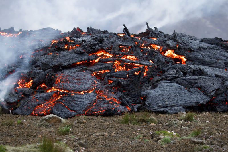
2. Smoke billows from flowing lava during an volcanic eruption at Litli Hrutur, south-west of Reykjavik in Iceland. A volcano erupted near Iceland's capital on July 10, 2023, the country's meteorological office said, marking the third time in two years that lava has gushed out in the area.
Eruption at Litli Hrutur, south-west of Reykjavik in Iceland (July 10, 2023) Photo: JEREMIE RICHARD/AFP via Getty Images
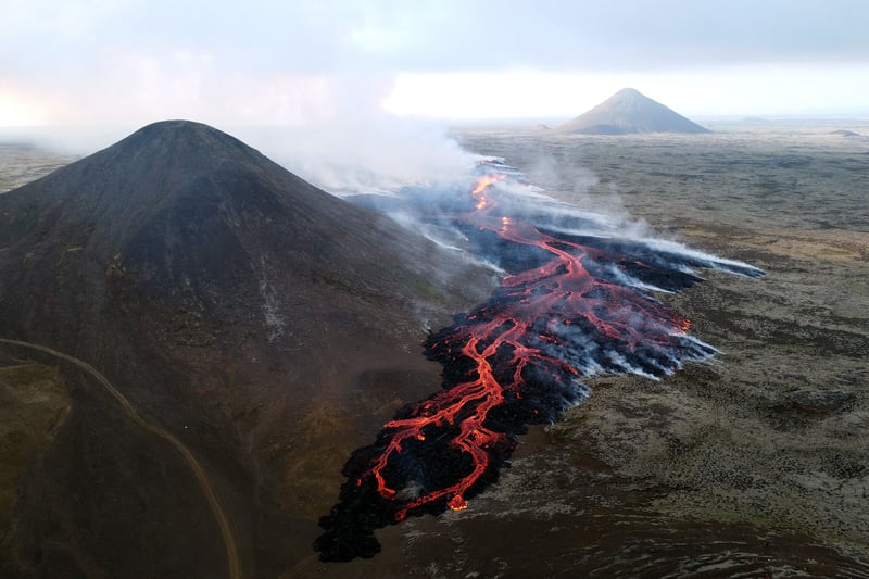
3. This aerial photo taken on July 10, 2023 shows smoke billowing from flowing lava during an volcanic eruption at Litli Hrutur, south-west of Reykjavik in Iceland.
Eruption at Litli Hrutur, south-west of Reykjavik in Iceland (July 10, 2023) Photo: JEREMIE RICHARD/AFP via Getty Images
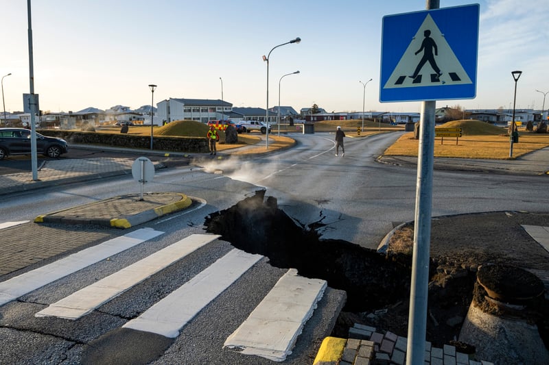
4. This photo taken on November 13, 2023 shows a crack cutting across the main road in Grindavik, southwestern Iceland following earthquakes. The southwestern town of Grindavik -- home to around 4,000 people -- was evacuated in the early hours of November 11 after magma shifting under the Earth's crust caused hundreds of earthquakes.
Grindavik (November 13, 2023) Photo: KJARTAN TORBJOERNSSON/AFP via Getty Images