
Polar vortex: Could the UK see another Beast from the East?

Something unusual is happening high above the Arctic, and it’s already prompted talk of another Beast from the East. Weather expert Gareth Butterfield explains why forecasters are watching the polar vortex and what it might mean for Britain
The polar vortex is something you're likely to hear about in the coming days, and you might hear it bandied about in the tabloids, accompanied by threats of a return of the "Beast from the East".
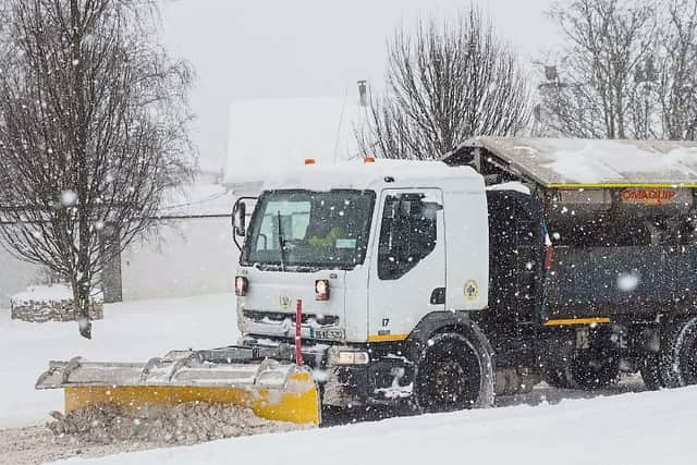

But the reality is far less simple than just declaring "snowmageddon" is looming large and we're all going to be plunged into an Arctic freezer.
What is the polar vortex?
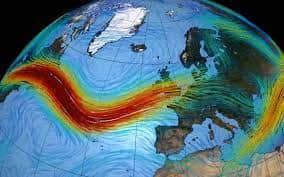
It's a broad band of strong winds that circles a pool of very cold air high above the Arctic. It forms as the polar region cools during autumn and winter, increasing the temperature difference between the Arctic and the air farther south.
These winds are in the stratosphere, around 10 to 50km above the ground, well above the layer where most of our weather happens. But if the vortex weakens or shifts, the effects can sometimes reach far enough down to change the path of the jet stream, which steers weather systems towards the UK.
Why are we suddenly hearing about the polar vortex?
This is because we we're set to see something called a Sudden Stratospheric Warming happening over the coming days. This occurs when air high above the Arctic heats up rapidly, sometimes by tens of degrees in a short space of time.
This can weaken or even reverse the strong winds of the polar vortex, and in turn disrupt the jet stream. This is why it matters to the UK and this is why you're hearing about it.
This current Sudden Stratospheric Warming is notable because it's happened so early in the season, and that can have a bearing on its effects.
Will it affect our weather?
It could. But there's just as much of a chance that it won't. We've had plenty of Sudden Stratospheric Warmings in the past, and they've had little to no effect on British weather.
Then again, we've had 2018's Beast from the East which happened when the jet stream shifted south and a blocking high developed over Scandinavia. This was as a result of the polar vortex being weakened, which was a result of a Sudden Stratospheric Warming.
Importantly, if we are going to see effects from this remarkably early Sudden Stratospheric Warming we probably won't see anything happening for a week or two, and it could be five days or so before the polar vortex reverses. So if something's going to happen, we should see it in the long-range forecasts soon.
But, remember, it's just as likely to build in uncertainty at this stage and send the models into a bit of confusion, so any long-term extreme forecasts you see are probably a bit glorified.
So what is the weather going to do this weekend and next week?
At the moment, high pressure is still in charge, albeit starting to hang on by a thread.
This means more of the same for much of the country - gloomy days, little in the way of temperature extremes, staying largely dry, and fairly calm.
By Tuesday a more easterly influence will bring temperatures down a bit, before showers develop through the afternoon, with a more soggy spell sweeps in, lasting into Thursday.
As we move towards the end of the week, high pressure should regain control and we could be in for a pleasant, if rather chilly weekend.
Beyond next weekend there are hints of something stormy developing, but the long term outlook generally paints an unsettled picture which could take us well into December. And then it's all eyes on that polar vortex.