UK Weather: How long is Storm Pia going to last? - Met Office forecast for Christmas
and live on Freeview channel 276
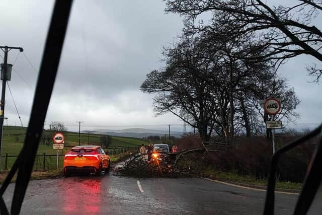
Storm Pia has ripped across the UK with high winds of up to 80mph causing damage to property and roadways in parts of England. The extreme weather has prompted widespread warnings from the Met Office as many want to known if conditions will clear before Christmas Day.
The Met Office has issued a yellow weather warning for wind from midnight to 9pm on Thursday (December 21) as high winds continue to batter the northern half of the UK today. Areas in Derby and Manchester have been particularly affected by the storm with downed trees blocking roads and traffic. But when will the strong winds end, and will it be in time for people to travel home safely for Christmas?
Advertisement
Hide AdAdvertisement
Hide AdWhen will Storm Pia end?
Fortunately, Storm Pia - which was named by the Danish Met Institute - is set to gradually move towards mainland Europe by Thursday evening, according to the Met Office. While it will remain windy for many in the UK on Friday, the worst of the storm is forecast to hit the mainland of Europe in the coming days.


For parts of Scotland, yellow warnings for snow and ice have been issued for Shetland and northeastern areas for the coming days. Travel disruption is likely for Shetland where 2-5 cm of snow is possible, according to the forecaster.
What is the Met Office forecast for lead up to Christmas?
According to the Met Office forecast, conditions are likely to remain unsettled for the weekend with strong winds and rain forecast for parts of the UK. West and northwest England are forecast to see the most rain while central and eastern areas of the UK are likely to remain mostly dry.
Met Office Deputy Chief Meteorologist Dave Hayter said: “It’ll be a particularly wet weekend in the north and west, with breezy conditions for many. While those further south will generally be drier, some sporadic showers could spread into the southwest at times, as well as some more persistent rain for Wales on Sunday.
Advertisement
Hide AdAdvertisement
Hide Ad“Christmas Day will likely see a continuation of unsettled, mainly showery, weather in the northwest, including Northern Ireland. While the day may start damp in southern and central areas, that rain should clear into the English Channel through the evening.”
Comment Guidelines
National World encourages reader discussion on our stories. User feedback, insights and back-and-forth exchanges add a rich layer of context to reporting. Please review our Community Guidelines before commenting.
