Snow forecast: Met Office warns of 'disruptive' snowbomb as arctic blast set to hit UK

and live on Freeview channel 276
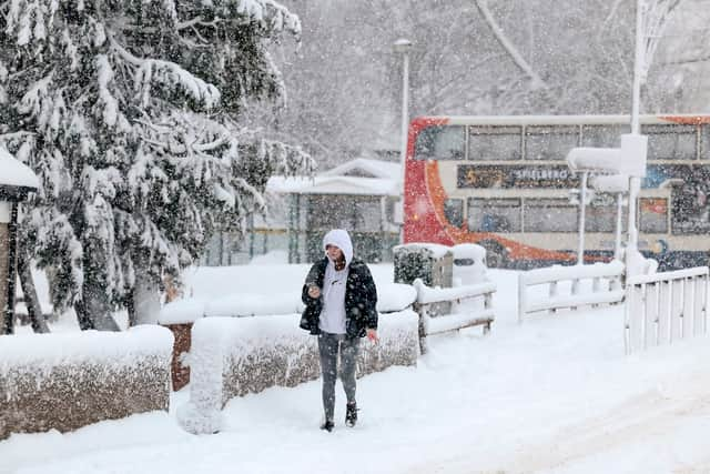
The Met Office has warned of 'disruptive' snow as an arctic blast is set to bring cold air to the UK next week. The national forecasters said temperatures will plunge further from Sunday (January 14) and into early next week, with snow showers expected to hit northern areas of Scotland and Northern Ireland.
The cold conditions will remain until the middle of next week, they said, with the potential arrival of disruptive snow in some areas as milder Atlantic air pushes in from the southwest.
Advertisement
Hide AdAdvertisement
Hide AdMet Office Deputy Chief Meteorologist David Hayter, said: “While the initial snow risk from Sunday onwards is looking most likely to be coastal areas in the north of the UK, including North Sea and Irish Sea coasts, there’s an ongoing likelihood of some disruptive snow through the middle to latter part of next week.
“What we’re keeping an eye on for this disruptive snow is where exactly this milder air from the southwest bumps into the cold air that will be in place over the UK. It’s where these airmasses meet that there’s a likelihood of some substantial snow for some places.
"At the moment, models are showing us a variety of options for exactly when and how this situation plays out and it’s something we’ll be able to add more details to in the coming days.”

Earlier this week, the UK Health Alert Agency (UKHSA) issued an amber cold health alert for certain regions of England amid the Met Office's warning of overnight sub-zero temperatures in the coming days. An amber alert indicates the possibility of significant impacts for the health and social care sector.
Advertisement
Hide AdAdvertisement
Hide AdDr Agostinho Sousa, Head of Extreme Events and Health Protection at UKHSA, said: “The temperatures we will see leading into the weekend can rapidly have a serious impact on the health of those over the age of 65 and those with pre-existing health conditions as it increases the risk of heart attacks, strokes and chest infections. It is therefore vital to check in on friends, family and neighbours to ensure they are well prepared for the cold weather next week.”
RAC Breakdown spokesperson Simon Williams said: “With an increasing risk of snow and ice at the start of next week we urge drivers to make sure they travel fully prepared. Having a few essential items in the boot – no matter what distance you’re going – can make a massive difference in a breakdown situation in freezing conditions. A warm, waterproof coat, sturdy footwear and gloves, along with a blanket and a power bank to keep your phone charged are vital.
“While no one sets out to breakdown or get stuck in very cold, potentially snowy conditions, there are far too many instances where drivers have underestimated the severity of the conditions and found themselves in danger. It’s far better to prepare for the worse and hope for the best.”
UK 5-day weather forecast
Thursday (January 11)
Sunshine across the south of England becoming increasingly confined towards the southwest. Some sunny spells across western Scotland and Northern Ireland too. Otherwise rather cloudy with some drizzle in the northeast. A little less cold, but still feeling chilly. A dry evening with cloud continuing to push westwards, perhaps thick enough for some drizzle over the hills overnight. A patchy frost possible underneath the clearest skies in the west.
Advertisement
Hide AdAdvertisement
Hide AdFriday (January 12)
Often cloudy, mostly dry, with occasional sunny intervals and the odd spot of drizzle possible over the hills. Still feeling chilly with generally light winds. Rain later in northern Scotland.
Rather cloudy over the weekend with some sunny spells and showery rain on Sunday. Showers, possibly wintry, along the coasts on Monday with brighter skies elsewhere. Turning colder.
Comment Guidelines
National World encourages reader discussion on our stories. User feedback, insights and back-and-forth exchanges add a rich layer of context to reporting. Please review our Community Guidelines before commenting.