Is snow forecast for next week? Which areas of the UK could be hit with cold snap as temperatures drop to -1C

and live on Freeview channel 276
It may not seem like that long ago since the UK was dealing with highs of 40C in a series of heatwaves during the summer which brought temperatures never experienced before in living memory.
But, now, as we progress into autumn, people are being warned that the weather is about to drastically change, temperatures are about to drop and snow is on the way.
So, just when and where is the snow expected to fall?
Here’s what you need to know.

When is snow forecast in the UK?
Advertisement
Hide AdAdvertisement
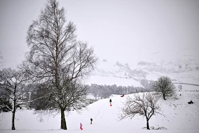
Hide AdSnow has been forecast in the UK for the last days of September.
Jim N. R. Dale, the founder of British Weather, which is the UK’s longest established independent meteorological company, has warned people that a cold snap is on the way next week (week commencing 26 September).
A tweet on Tuesday 20 September, simply read: “Cold plunge arriving this time next week. Heating on?”
Where is snow forecast in the UK?
Experts believe that parts of Scotland are most likely to experience some snow in the coming days, but the cold front that’s coming will see temperatures drop right across the UK.
Advertisement
Hide AdAdvertisement
Hide AdDale said that, although September may feel a little early for snow, it is not that unusual for the white stuff to fall north of the Scottish border, particularly in the Scottish Highlands.
He told the Daily Express: "It’s the start of all things. Across mountain tops, it is increasingly usual as October unwinds."
Parts of Scotland will see small, isolated, snow showers with under 1cm laying, near Fort William by midday on Monday (26 September), according to WX Charts, an interactive weather model.
The map indicates that the snow will fall in and around Ben Nevis, the highest peak in Britain, stretching north to Inverness.
Advertisement
Hide AdAdvertisement
Hide AdIn the Scottish Highlands, light snowfall is also predicted to lay east of Portree, in the north west, and further south between Ayr and Kilmarnock.
Other areas may escape the snow fall, but will instead experience heavy rainfall.
On Tuesday (27 September), deeper snow is set to settle again on the Scottish Highlands at Portree and at Fort William by 6am.
It’s expected, however, that any snow fall will have disappeared by the evening and there will be no trace of the white stuff left on the ground.
What will the temperature be in the UK?
Advertisement
Hide AdAdvertisement
Hide AdUnsurprisingly, the temperatures will plummet as the snow falls.
The temperature is only expected to reach 4C in central Scotland on Monday and by Tuesday it could be even colder, with forecasters predicting it will be around 2C. Temperatures could also drop to as low as -1C.
Elsewhere in the UK, temperatures are also going to be low at the beginning of the week. In the south, temperatures will struggle to get above 7C.
By the end of the week, temperatures will climb back up to 15C in the south of England.
Will it definitely snow next week in the UK?
Advertisement
Hide AdAdvertisement
Hide AdWhile one forecaster is predicting snow for some next week, another forecaster believes that most of the UK will just see rain.
The Met Office long range forecast states that there will be a “fine and dry start to the period for most”, between Sunday 25 September and Tuesday 4 October, but it will probably turn more unsettled.
According to Met Office experts, “a band of rain and cloud will arrive in the northwest during Sunday and spread quickly southeastwards.”
“Winds generally light but becoming strong in the northwest later with gales or severe gales likely. After a chilly start, temperatures should be close to average, perhaps becoming cool.
Advertisement
Hide AdAdvertisement
Hide Ad“Through the remainder of September, conditions are likely to remain changeable with further frontal systems spreading from the west and northwest at times.
“The wettest conditions with periods of strong winds are likely in the west of the UK, with the driest weather in the southeast. Similar conditions are expected for the start of October.
“Temperatures becoming close to average once again, or perhaps just above average.”
Comment Guidelines
National World encourages reader discussion on our stories. User feedback, insights and back-and-forth exchanges add a rich layer of context to reporting. Please review our Community Guidelines before commenting.