Storm Gladys: will it follow Storm Franklin, UK weather forecast, when it’s due - what will be the next storm?

and live on Freeview channel 276
In less than a fortnight, the UK has been struck by three storms deemed powerful enough to be named by the Met Office.
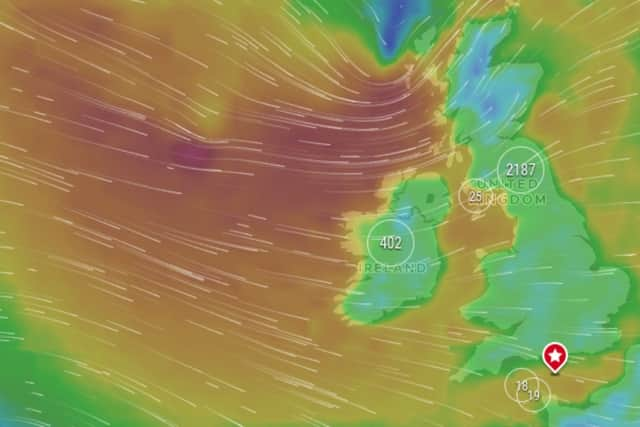
Dudley, Eunice and now Franklin have all brought their impressive winds to our shore, driven by a jet stream that seems to be pointed right at the UK, and is producing storms more regularly than usual.
Advertisement
Hide AdAdvertisement
Hide AdIndeed, three named storms in such quick succession is a first since the system was introduced seven years ago.
The new storms list – first launched in 2015 – for each year generally runs from early September until late August the following year, coinciding with the beginning of autumn.
Storms are named when they have the potential to cause an amber or red weather warning.
A list of possible names are compiled by Irish forecaster Met Eireann, the UK’s Met Office and the Dutch national weather forecasting service KNMI.
Advertisement
Hide AdAdvertisement
Hide AdBut it seems there could be no let up for Brits, as the next name on the 2021/22 list - Gladys - looks set to be used.
When will Storm Gladys hit?
At the time of writing, no weather system has officially been named as Storm Gladys by the Met Office.
That means there’s no watertight indication of when - or even if - such a storm will affect the UK.
However, take a look at the forecast for much of the UK, and you’ll see that strong winds are forecast for later in the week, on Thursday 24 February.

Advertisement
Hide AdAdvertisement
Hide AdIt is thought that should these winds increase in their potential strength, the Met Office could take the decision to name the system Storm Gladys.
That would make Storm Gladys the fourth named storm to hit the UK in quick succession, in the space of about two weeks.
What is the forecast?
While the news of the potential for another named storm is the last thing many of us want to hear as spring creeps over the horizon, it’s likely if Gladys were to materialise, it would be less severe then previous storms.
“The risk of further impacts from wind and rain is much lower than we have seen in recent days, particularly across the south,” says the Met Office’s forecast for the week ahead.
Advertisement
Hide AdAdvertisement
Hide AdMet Office Chief Meteorologist, Andy Page, said: “A strong jet stream is driving weather systems across the North Atlantic with a succession of weather fronts moving into the UK bringing more wet and windy weather at times this week.”
“As Storm Franklin clears the UK and pushes into the near continent this afternoon the windy conditions will gradually ease and showers become fewer, leaving some dry, sunny weather for many.”
Thursday is potentially the coldest day of the week with a frost to start for some. Gusty winds and heavy rain continue to move south and east across the country, clearing the Southeast of England by lunchtime.
Why are there so many storms?
Of course, storms are nothing new for the UK, especially at this time of the year.
Advertisement
Hide AdAdvertisement
Hide AdBut to have had three - with a possible fourth on the way - so soon after one another is unusual.
“This is the first time we have had three named storms within a week, and we started the storm naming system in 2015,” Met Office meteorologist Becky Mitchell said.
So why are we seeing so many turbulent weather systems in recent days?
“At the moment we’ve got a really active jet stream, which is why we’re seeing so many storms track right towards the UK,” added Mitchell.
Advertisement
Hide AdAdvertisement
Hide AdThe jet stream, according to the Met Office, is “a core of strong winds around five to seven miles above the earth’s surface, blowing from west to east”.
It causes changes in the wind and pressure at that level and in turn affects things nearer the surface of the earth, such as areas of high and low pressure.
Sometimes the jet stream’s movements can be very straight and smooth - however “its movements can buckle and loop, like a river’s meander”.
The Met Office says that when this happens, it “will slow things up, making areas of low pressure move less predictably”.
Advertisement
Hide AdAdvertisement
Hide AdThe jet stream can also change the strength of an area of low pressure, with the weather service likening it to a “vacuum cleaner, sucking air out of the top and causing it to become more intense, lowering the pressure system”.
The lower the pressure within a system generally means the stronger the wind, and the more intense the storm.
A message from the editor:
Thank you for reading. NationalWorld is a new national news brand, produced by a team of journalists, editors, video producers and designers who live and work across the UK. Find out more about who’s who in the team, and our editorial values. We want to start a community among our readers, so please follow us on Facebook, Twitter and Instagram, and keep the conversation going. You can also sign up to our newsletters and get a curated selection of our best reads to your inbox every day.
Comment Guidelines
National World encourages reader discussion on our stories. User feedback, insights and back-and-forth exchanges add a rich layer of context to reporting. Please review our Community Guidelines before commenting.