UK snow 2023: When is the exact date and time the UK will be hit by a snow bomb? Full snow forecast

and live on Freeview channel 276
For those wondering when it will snow, they need wonder no more as a new map has revealed the answer.
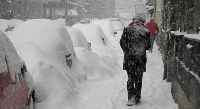
The Met Office has already predicted that we can expect snow in the UK in the coming days as "colder than average conditions" continue, but a new map suggests that a snow bomb which is the width of England is due to travel across the UK imminently.
Advertisement
Hide AdAdvertisement
Hide AdIt comes as temperatures dropped to below freezing overnight for the second consecutive night last night (Saturday November 25) as the autumn cold snap continues. Parts of Scotland, northern England and Wales also saw overnight temperatures below zero, dropping to minus 5c in parts of Scotland, with many other areas at or close to zero. So, when exactly will the snow bomb hit, and where? Here's what you need to know.
When will the snow bomb hit in the UK?
According to a weather map on WX Charts, the snow bomb will hit England next Thursday, November 30, at around 9am. The maps from WX Charts show large patches of purple, which symbolises snow, covering the UK.
Where will the snow bomb hit the UK?
The snow bomb is expected to cover the UK from Cardiff to London and up to Manchester - as well as along the west coast. There could be snow levels of up to 6cm an hour and a wave of rain with up to 5mm of rain an hour. Temperatures are forecast to be between -2C and 5C on Thursday.
Some snow could arrive in northern parts of the UK as early as Wednesday (November 29), but any snow that does fall acorss the country is expected to clear by late on Friday (December 1), according to WX Charts.

What has the Met Office said about the snow bomb?
Advertisement
Hide AdAdvertisement
Hide AdMet Office experts have said that the chances of the UK being completely covered in the white stuff are small - but there is indeed still a chance.
Met Office Deputy Chief Meteorologist, Dan Harris, said: “At present, the most likely outcome beyond mid-week is that rain from the west slowly moves east, with snow possible over higher ground, and a continued risk of showers over eastern parts.
"However, there is a chance that a more active weather system arrives from the southwest, which would bring more widespread rain, stronger winds, and the potential for more significant snowfall should the air over the UK become sufficiently cold ahead of it."
It's predicted that it will stay cold throughout the early part of next week, with frost continuing overnight. There will be outbreaks of rain gradually easing through Monday, before some brighter skies develop on Tuesday and Wednesday. However, the risk of snow has not been ruled out entirely by the Met Office for later in the week. The long range forecast for November 29 to December 8 said there will be "showery episodes with rain, sleet and possibly hill snow" across the country.
Advertisement
Hide AdAdvertisement
Hide AdAny sleet and snow showers would be most likely to affect northern and eastern coastal districts, according to the Met Office. The forecast also predicts that there remains a chance of more widespread snow spreading up from the south during at least the first part of this period, should this occur strong winds or even gales are possible across many parts, especially the south.
Comment Guidelines
National World encourages reader discussion on our stories. User feedback, insights and back-and-forth exchanges add a rich layer of context to reporting. Please review our Community Guidelines before commenting.