New Year’s Day weather: snow warning issued for parts of Scotland - here’s where to expect it
and live on Freeview channel 276
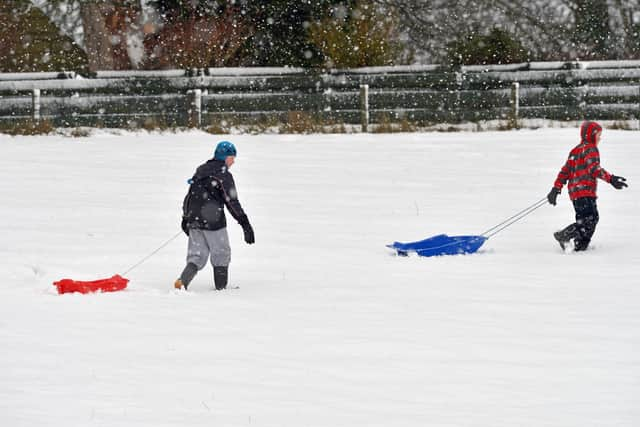
A weather warning for snow has been issued for parts of Scotland.
The Met Office is predicting flurries will fall in Central, Tayside & Fife, Grampian, Strathclyde and in Highlands & Eilean Siar on New Year’s Day (1 January). The yellow alert is in place from 3am until midday.
Advertisement
Hide AdAdvertisement
Hide AdIt comes after partygoers defied wet weather to welcome in 2023 across the UK. Mayor of London Sadiq Khan said he was “delighted” that Londoners and visitors could once again join together on the banks of the River Thames to ring in the new year.
People are being urged to monitor the Met Office’s website or app for any further weather warnings over the weekend. Next week there is expected to be calmer weather in the south as high pressure clings on and more unsettled conditions due to low pressure in the north.
Forecasters have said that the deadly bomb cyclone which sent temperatures plunging in the US is also causing the UK to experience wet and windy weather. The winter storm has killed at least 57 people in North America as well as knocking out power to hundreds of thousands of homes on Christmas Day.
Here is all you need to know about the alerts:
What to expect from the snow warning?
On its website, the Met Office advises: “Spells of snow, mainly over hills and mountains, may cause some travel distruption. Some roads and railways likely to be affected with longer journey times by road, bus and train services.
Advertisement
Hide AdAdvertisement
Hide Ad“Spells of hill snow developing over central and eastern Scotland Saturday night and Sunday morning will gradually ease during Sunday. Some sleet and snow may fall down to around 100 m at times but bulk of accumulations will be above 200 metres where 2-5 cm of snow is likely for some with perhaps 10 cm at higher elevations.”
A yellow warning for ice is also in place for parts of Grampian, Highlands & Eilean Siar and Orkney & Shetland until 11am. Residents are advised: “Rain, sleet and snow showers are expected to die out during Saturday but will leave surfaces wet with icy stretches forming on untreated surfaces overnight. Some further rain, sleet and perhaps snow will push northwards during Sunday morning over mainland Scotland with icy stretches then clearing from parts of eastern Scotland.”

Where are weather warnings are in place?
The yellow warning for snow is in place for the following parts of Scotland:
- Angus
- Clackmannanshire
- Falkirk
- Perth and Kinross
- Stirling
- Aberdeenshire
- Moray
- Highland
- Argyll and Bute
- East Dunbartonshire
- North Lanarkshire
- West Dunbartonshire
The Met Office’s ice alert covers:
- Aberdeen
- Aberdeenshire
- Moray
- Na h-Eileanan Siar
- Highland
- Orkney Islands
- Shetland Islands
Is it the result of the US bomb cyclone?
Met Office Meteorologist Simon Partridge said the wet and windy weather was being caused by the bomb cyclone in the US. “The UK weather is going to remain unsettled with further spells of wet and windy weather due to the strengthening of the jet stream because of the weather in the US,” he said.
Advertisement
Hide AdAdvertisement
Hide AdMr Partridge added that the impact on the UK would be “nowhere near” as significant as it was on the US. “The effect it’s having on the UK is nowhere near as dramatic because that system has brought up a lot of cold air further south, across the US,” he explained.
Indeed, the cyclone is only having an effect on the UK due to its impact on the North Atlantic jet stream. “What effect (the bomb cyclone) has had is to strengthen the jet stream, because the jet stream is basically driven by temperature differences. So the starker the difference in temperature between the northern edge of it and southern edge, the stronger the jet stream becomes.”
He said the knock-on effect for the UK is spells of wet and windy weather over the next seven to 10 days.
Comment Guidelines
National World encourages reader discussion on our stories. User feedback, insights and back-and-forth exchanges add a rich layer of context to reporting. Please review our Community Guidelines before commenting.