
Hurricane Erin: Tropical storm reaches speeds of up to 160mph and could triple in size - will it impact UK weather?

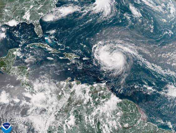

Forecasters are warning that Hurricane Erin could triple in size over the next week as the tropical storm strengthens in the Atlantic Ocean.
Erin is the first Atlantic hurricane of the year, the fifth named storm of the season and is currently travelling across the Caribbean. It is not expected to make landfall, but could bring flooding rain to the region.
The storm intensified over night, reaching speeds of up to 160mph and briefly being categorised as a rare Category 5 storm before being slightly downgraded again to Category 4, with maximum sustained winds of up to 140mph.
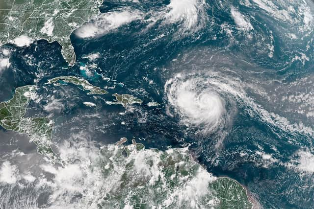
Forecasters has expected the storm to fluctuate in size over the rest of the weekend before possibly doubling or even tripling in size over the next week. This could bring rough conditions over the western Atlantic, which in turn could create powerful rip currents off the eastern coast of the US.
While the storm is not expected to make landfall in any of the northeastern Caribbean island, a number of tropical storm watches were previously introduced in St Martin, St Barts, St Maarten, and southeast Bahamas. A tropical storm warning was introduced in Turks and Caicos.
The National Hurricane Centre said in an advisory update: “Tropical storm conditions are expected across the warning area in the Turks and Caicos Islands beginning tonight (August 16). Tropical storm conditions are possible in the watch area in the Southeast Bahamas tonight and Monday.
“Squalls with wind gusts to tropical storm force could occur over portions of the Virgin Islands and Puerto Rico today and across the central Bahamas Monday and Tuesday.”
It added: “Swells generated by Erin will continue to affect portions of the Virgin Islands, Puerto Rico, Hispaniola, and the Turks and Caicos Islands during the next couple of days. These swells will spread to the Bahamas, Bermuda, the east coast of the United States, and Atlantic Canada during the early and middle portions of the week.
“These rough ocean conditions will likely cause life-threatening surf and rip currents. Please consult products from your local weather forecast office for more information.”
Will Hurricane Erin reach the UK?
While the UK is not set to get hit by the tropical Atlantic hurricane, Erin could have an impact on our weather over the next week and beyond. The Met Office has said: “From Monday [August 18] onwards, the forecast becomes more complex, with tropical storm Erin potentially influencing UK weather.
“While warmth is likely to persist, the risk of showers and wind increases, and the exact outcome will depend on Erin’s trajectory and its interaction with the jet stream.”