Is it safe to drive during a thunderstorm? Met Office advice as yellow weather warning issued
and live on Freeview channel 276
A thunderstorm warning is set to come into force in the coming hours.
The Met Office has issued a yellow weather alert for parts of England, Wales and Northern Ireland.
Advertisement
Hide AdAdvertisement
Hide AdIt comes into force at 8pm today (4 September) and remains in place until Monday (5 September) morning.
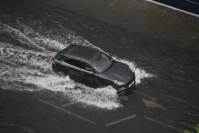
Forecasters warn that there could be disruption to travel including trains due to the storms.
But is it safe to travel during a thunderstorm?
Here is what the advice says:
Is it safe to drive during a thunderstorm?
On its website, the Met Office says: “If you are caught out in thunder and lightning it is advised that you wind up the windows and stay inside your car.
“This is because in the vast majority of cars with a metal roof and frame, the frame will act as a conductive Faraday cage, passing the current around the passengers inside and on to the ground.”
Advertisement
Hide AdAdvertisement
Hide AdSoft-top convertibles, with their fabric roofs, are the most at risk and could catch fire if struck by lightning.
Be aware that current can travel through other parts of many modern cars, including GPS and radio systems. Cars with metal interior handles, foot pedals and steering wheels can also carry current.

Cars can be damaged both internally and externally by lightning strikes.
The Met Office continues: “Thunderstorms can also bring a risk of sudden gusty winds, those most at risk would include cyclists, motorcyclists and high sided vehicles.
Advertisement
Hide AdAdvertisement
Hide Ad“Remember to give vulnerable road users including cyclists, motorcyclists and pedestrians more room than usual. They are more likely to be blown around by side winds – always keep a safe distance.
“Keep your speed down, lowering your speed will lower the distance you travel when buffeted around by the wind.”
Where is the weather warning in force?
The Met Office has a yellow warning in place from 8pm on Sunday until 4am on Monday, with the weather potentially causing some localised disruption.
The warning covers London and south-east England, south-west England, most of Northern Ireland, large parts of Wales, east of England, Northamptonshire and Warwickshire.
It is also in place for Northern Ireland.
Advertisement
Hide AdAdvertisement
Hide AdThere is a good chance driving conditions will be affected by spray or hail, and there will probably be some damage to buildings and structures from lightning strikes and gusty winds.
Flooding of homes and businesses is possible, and there could be delays to train services.
Forecasters say that some short-term loss of power and other services is also possible.
What does the Met Office warning say?
On its website, the forecaster warns: “Heavy showers and thunderstorms are expected to develop across southwest England on Sunday evening and move north across parts of Wales and Northern Ireland, clearing during the early hours of Monday morning.
Advertisement
Hide AdAdvertisement
Hide Ad“A separate area of thunderstorms is likely to develop across central southern England late evening, moving north into the Midlands overnight.
“Whilst some places may not see much rainfall, a few places may see 20-30 mm fall in under an hour.
“Frequent lightning, hail and locally gusty winds are additional hazards that may accompany stronger thunderstorms, particularly across southwestern parts of England and Wales.”
Comment Guidelines
National World encourages reader discussion on our stories. User feedback, insights and back-and-forth exchanges add a rich layer of context to reporting. Please review our Community Guidelines before commenting.