
Storm Herminia weather warnings: Heavy rain brings flooding risk - full list of alerts and warnings

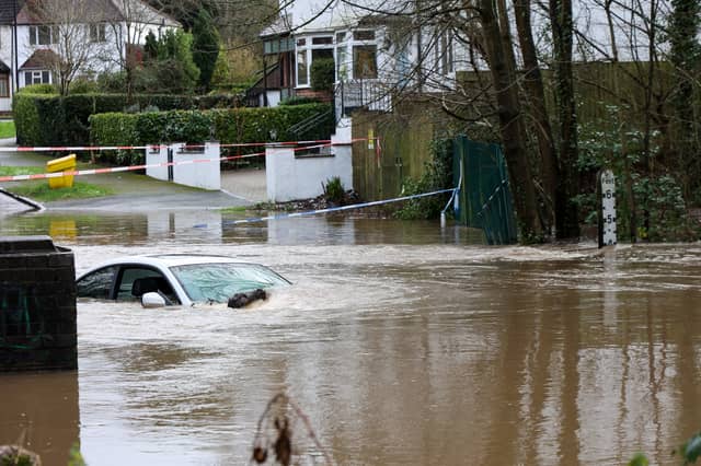

Flooding is a real possibility across large parts of the UK as wind and rain pummel the country as spin-offs from Storm Herminia.
The Met Office has issued a yellow warning of spells of rain which could lead to localised flooding covering South and West Wales until 9pm on Tuesday.
While Natural Resources Wales has removed a series of flood warnings, Libanus in the Brecon Beacons saw 34.6mm of rain on Monday and nine flood alerts remain in place.
Another yellow alert for rain covering parts of southern England runs until 10am on Tuesday, warning of heavy rain, possible thunderstorms and flooding, while a yellow wind alert for southern England and parts of Wales is in force until 6am on Tuesday.
Gusts of 84mph and almost 60mm of rainfall hit parts of southern England on Monday.
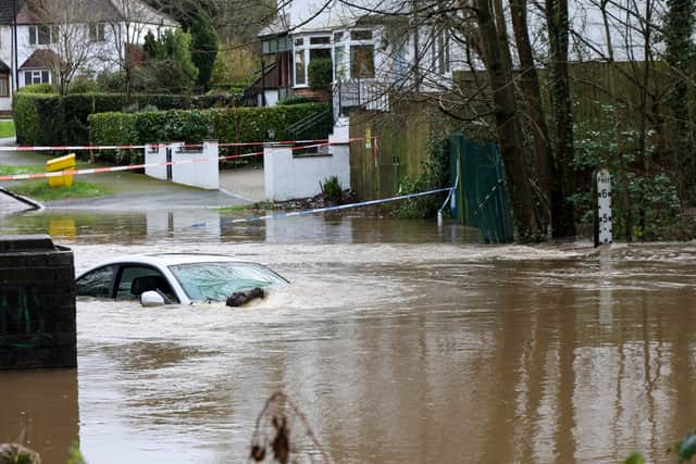
The Environment Agency had 37 flood warnings, where flooding is expected, in place in the south of England and the Midlands on Tuesday morning. A further 171 alerts, where flooding is possible, were in place across England.
The bad weather is linked to Storm Herminia, a low-pressure system named by meteorologists in Spain, which was expected to feel the strongest winds.
Somerset Council said a major incident in the region, jointly declared with the police and other agencies, would be maintained until further notice with more rain forecast on Tuesday and Wednesday. Somerton Fire Station said 61 people were rescued from flooded properties, including a mobile home site in Charlton Adam, and temporarily relocated to Edgar Community Hall.
National Highways said one lane of the A303 was closed westbound near Yeovil because of flooding on Tuesday morning, while an eastbound lane was closed near Mere in Wiltshire while work continues to clear water.
Met Office meteorologist Marco Petagna said the rain warnings are suggesting further flooding is possible until Tuesday evening.

He said: “The trend over the next few days is for things to gradually improve a bit. These warnings for rain are suggesting further flooding is quite possible, especially within the warning area.”
After a day of sunshine and showers on Tuesday, heaviest with the chance of hail and thunder in the south, the Met Office said rain is expected to ease overnight bar some heavy patches in the north of Scotland and Northern Ireland.
Mr Petagna said Wednesday and Thursday will be mostly fine, but with a small chance, the far south of England could see some outbreaks of rain.
Around 50,000 customers remained without electricity across Northern Ireland on Monday evening after Storm Eowyn hit at the weekend, according to Northern Ireland Electricity Networks. Scottish and Southern Electricity said it had restored power to 90,000 customers affected by Storm Eowyn and was working to reconnect a further 1,700.
Director of customer operations for the north of Scotland Andy Smith said: “This storm has been the most destructive for parts of our network in many years and rebuilding damaged overhead lines has been a huge task.”
Flood warnings - flooding is expected
- Bristol Avon (lower) from Twerton to Bristol
- Bristol Avon (middle) at Bradford on Avon
- Bristol Avon (middle) from Melksham to Bathford, not including Bradford on Avon
- Bristol Avon (upper) from Chippenham to Melksham
- Bristol Avon (upper) from Malmesbury to Chippenham
- Fittleworth on the Western River Rother
- Groundwater Flooding for the Till
- Lower Frome from East Stoke to Wareham
- Lower Stour at Redhill and Wheatplot Home Sites
- Lower Stour at Stour Park Homes
- Lower Stour from Sturminster Marshall to Christchurch
- Middle Hampshire Avon at Britford, Salisbury
- Middle Hampshire Avon at St Marys Cathedral area, Salisbury
- Middle Hampshire Avon at The Close and West Harnham, Salisbury
- Middle Hampshire Avon from Salisbury to Ringwood
- Middle Stour from Hammoon to Sturminster Marshall
- Poole Harbour at Wareham
- Properties closest to the River Kennet at the Burghfield, Southcote, Coley and Holybrook areas
- River Axe (Lower) from Axminster to Axmouth
- River Axe (Mid) at Axminster
- River Axe (Upper) from Winsham to Axminster, including Chard Junction and Weycroft
- River Brue and Glastonbury Millstream from Lovington to Highbridge, low lying properties
- River Clyst from Broadclyst to Clyst St. Mary
- River Dene at Walton
- River Ivel at Langford
- River Loddon and River Blackwater at Swallowfield
- River Severn at Severn Ham, Tewkesbury
- Rivers Stour and Iwerne at Stourpaine
- River Wey at Elstead and Eashing
- Semington Brook from upper reaches to Semington
- Upper Hampshire Avon, Upavon to Amesbury
Flood alerts - flooding is possible
- Bear Brook and tributaries in the Aylesbury area, including Wendover and Weston Turville
- Bow and Piddle Brook
- Burton Trent
- Chertsey Bourne
- Christchurch Harbour
- Climping Seafront
- Colne Brook at Iver and Colnbrook
- Cranleigh Waters
- Cuckmere River
- Cut
- Danes Stream
- East coast of Dorset
- East Somerset Rivers
- Emm Brook and Queen's Brook
- Ginge Brook
- Groundwater Flooding in Deane and Ashe in North Hampshire
- Groundwater Flooding in Flamstead
- Groundwater Flooding in Hursley
- Groundwater Flooding in Kimpton and Lilley Bottom
- Groundwater Flooding in the Candovers and Old Alresford
- Groundwater Flooding in the Cranborne Chase area
- Groundwater Flooding in the Great Shefford area
- Groundwater Flooding in the Henley and Assendon area
- Groundwater Flooding in the Lambourn Valley catchment
- Groundwater Flooding in the Salisbury Plain area
- Groundwater Flooding in the West of Dorset
- Groundwater Flooding in villages surrounding Andover
- Groundwater Flooding in West Ilsley, East Ilsley, Compton, Chilton and West Hagbourne
- Hayling Island
- Hoe Stream
- Isle of Wight coast
- Kempsey Village
- Lower Arun
- Lower Avon and tributaries
- Lower Bristol Avon area
- Lower Frome and tributaries
- Lower River Cam in Cambridgeshire
- Lower River Colne and Frays River
- Lower River Derwent
- Lower River Loddon
- Lower River Loddon at the River Thames confluence at Twyford
- Lower River Medway
- Lower River Soar in Leicestershire
- Lower River Wey
- Lower Stour and tributaries
- Lower Teme
- Lower Tone and Parrett Moors
- Lower Torridge area
- Lymington River
- Mansbridge and Riverside Park
- Mid Bristol Avon area
- Mid Devon Rivers
- Middle Avon Rugby to Bidford
- Middle Exe area
- Middle Hampshire Avon and tributaries
- Middle River Great Ouse in Milton Keynes, Bedford Borough and Central Bedfordshire
- Middle River Medway
- Middle Stour and tributaries
- North Dartmoor Rivers
- North Sea coast at Bridlington
- River Adur East Branch
- River Arrow in Herefordshire
- River Avon in Worcestershire
- River Axe area
- River Beult from Pluckley and Bethersden to Stilebridge
- River Biss catchment
- River Blackwater
- River Blackwater and The Cove Brook
- River Blythe in Warwickshire
- River Bourne and tributaries
- River Chew catchment
- River Churn and its tributaries
- River Churnet and River Tean
- River Cole, Dorcan Brook and South Marston Brook
- River Darent from Westerham to Dartford
- River Dart area
- River Dee catchment in England from Whitchurch to Chester
- River Dene in South East Warwickshire
- River Dikler from Condicote to Little Rissington
- River Dun
- River Enborne and Foudry Brook
- River Evenlode from Moreton in Marsh to Cassington and also the River Glyme at Wootton and Woodstock
- River Foulness and Market Weighton catchment
- River Great Ouse in Cambridgeshire from Brampton to Earith
- River Ivel in Hertfordshire and Central Bedfordshire
- River Kennet and its tributaries from Berwick Bassett down to Newbury
- River Kennet from Thatcham down to Reading
- River Lambourn and its tributaries from Upper Lambourn down to Newbury
- River Leadon catchment
- River Leam and River Itchen
- River Lox
- River Lugg south of Leominster
- River Mole and its tributaries from Kinnersley Manor to South Hersham
- River Ock from Watchfield to Abingdon, and also the Letcombe Brook at Wantage, Grove and East Hanney
- River Pang from East Ilsley to Pangbourne and Sulham Brook
- River Piddle and tributaries
- River Ray and its tributaries from Shipton Lee to and including Islip
- River Ray and Swinbourne for West Swindon area to above Water Eaton
- River Rother and its tributaries from Turks Bridge to the Royal Military Canal
- River Rye catchment
- River Salwarpe
- Rivers Clyst and Culm and their tributaries
- Rivers Eden and Eden Brook
- River Severn in Gloucestershire
- River Severn in Worcestershire
- Rivers in South Worcestershire
- Rivers in the Forest of Dean
- Rivers Otter and Sid, and Exmouth area
- River Sow and River Penk
- River Stour and Smestow Brook in the Black Country and South Staffordshire
- River Stour in South Warwickshire
- Rivers Yeo and Parrett, downstream of Yeovil to Steart
- River Teign area
- River Thame, Horsenden Stream and Chalgrove Brook
- River Thames and its small tributaries from Calcutt to Lechlade
- River Thames and its tributaries from Days Lock to above Pangbourne
- River Thames and tributaries from Buscot Wick down to Kings Lock
- River Thames and tributaries in the Oxford area
- River Thames for Henley, Remenham, Medmenham and its tributaries
- River Thames for Shiplake, Lower Shiplake and Wargrave
- River Thames for the Abingdon area
- River Thames from Hurley to Cookham
- River Thames from Shepperton to Molesey
- River Tone catchment
- River Tove in Northamptonshire
- River Trent in Derbyshire
- River Uck
- River Whitewater and River Hart
- River Windrush from Bourton to Newbridge
- River Worfe
- River Wye in Derbyshire
- River Wye in Gloucestershire
- River Wye in Herefordshire
- River Wylye and tributaries
- River Yeo and River Parrett Moors around Muchelney and Thorney
- Severn Vyrnwy confluence
- Somerset coast at Porlock Weir
- Somerset Frome area
- South Cornwall coast from Gribbin Head to Rame Head
- South Cornwall Coast from Lands End to Lizard Point
- South Cornwall coast from Lizard Point to Gribbin Head excluding the Tidal Fal Estuary
- South Devon coast from Dawlish Warren to Seaton
- South Devon Rivers
- South East Somerset Rivers, Upper Reaches
- South Somerset Rivers, Upper Reaches
- Tern and Perry catchments
- The Essex coast from Shoeburyness, to and including Southend seafront, including Southchurch Park
- The Rivers Deben and Lark
- Tidal River Ouse from Naburn Lock to Selby
- Tillingbourne
- Tributaries on the Upper River Thames above Cricklade
- Upper Arun
- Upper Avon River Swift and Clay Coton Brook
- Upper Bristol Avon area
- Upper Hampshire Avon and tributaries
- Upper Ouse
- Upper River Derwent
- Upper River Great Ouse in Northamptonshire, Oxfordshire and Buckinghamshire
- Upper River Medway
- Upper River Ouse
- Upper River Tamar
- Upper River Wey
- Upper Stour and tributaries
- Upper Teme
- West coast of Dorset
- Western Rother
- West Somerset Streams
- Windle Brook and Hale, Mill and Addlestone Bournes