UK snow: Met Office issues amber cold weather alert as freezing temperatures and snow expected
and live on Freeview channel 276
An amber cold weather alert has been issued as snow is expected next week.
The warning is in place for northern England from Monday (6 March) until Thursday (8 March), yellow alerts are also in place for the rest of the country during the same period. It has been trigged as the Met Office forecast a 60% chance of severe cold weather, icy conditions or heavy snow.
Advertisement
Hide AdAdvertisement
Hide AdThe forecasters last month said that a sudden stratospheric warming (SSW) was “likely” bringing a risk of wintry conditions to the country. It is the same event that caused the Beast from the East in 2018, which brought heavy snow to large swaths of the UK.
The Met Office explains: “This means that northern Europe, including the UK is likely to get a long spell of dry, cold weather, whereas southern Europe will tend to be more mild, wet and windy. On the boundary of these areas, cold easterly winds develop and in some cases the drop in temperatures leads to snow, which is what happened in early 2018.”
Forecasts are predicting snow, sleet and wintry weather earlier next week and it has triggered a cold weather alert. Here is all you need to know:
What is a cold weather alert?
A level two yellow warning has been issued for every part of England, from the north east down to Cornwall, early next week. Explaining what it means, the Met Office said: “The Cold Weather Alert operates in England from the 1 November to 31 March every year, in association with the UK Health Security Agency (UKHSA). The alerts give you advanced warning of adverse weather conditions that could have a significant effect on your health and well-being, enabling you to take extra precautions to keep safe and well.

Advertisement
Hide AdAdvertisement
Hide Ad“However, should thresholds for an alert be reached outside of this period, an extraordinary cold weather alert will be issued and stakeholders are advised to take the usual public health actions. Alerts are issued on our website and we also send the alerts directly to social and healthcare services in England, and Age UK, to ensure that staff are fully prepared for any cold weather periods, and those who are more vulnerable to cold weather conditions are aware and prepared.”
The Met Office adds that a cold weather alert is issued when the mean temperature falls below two degrees Celsius for 48 hours or longer and / or there is heavy snow, widespread ice and other wintry conditions.
There are four levels of alerts:
- Level one - winter prepardness and action
- Level two - alert and readiness
- Level three - severe weather action
- Level four - national emergency
What does the amber cold weather alert say?
The level three warning is in place from 12.01am on Monday (6 March) until 11.59pm on Thursday (9 March)>
It covers north east England, north west England and Yorkshire and the Humber. The Met Office explains: “There is an increased confidence that a period of very cold weather will develop across the country from early next week, as a north or northeasterly airflow becomes established across the UK. The highest confidence is for northern parts where cold weather is expected to develop from early on Monday, progressing southwards through the day.
Advertisement
Hide AdAdvertisement
Hide Ad“Below average temperatures are expected throughout, bringing a widespread frost and wintry showers, these frequent along exposed windward coasts along with a risk of ice hazards. There is also a risk of more prolonged snow, perhaps due to rain pushing into the west from around midweek, although this is currently considered to be low confidence. This alert is likely to be updated and perhaps extended next week.”
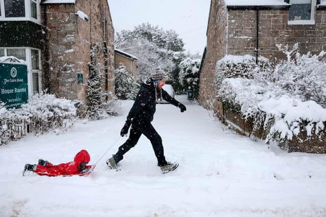
Is snow expected next week?
The Met Office has advised that an arctic maritime airmass will bring snow showers to Scotland, Northern Ireland and along the East coast of England from 6 March. The snow showers will predominantly impact northern and eastern areas; however it will be cold across the UK, with widespread freezing conditions overnight.
Deputy Chief Meteorologist, Chris Almond, said: “Although we’ve moved into meteorological Spring there will be a distinctly wintry feel to our weather next week. Very cold air will spread across the UK bringing snow showers even to sea level in the north on Monday and these snow showers could spread further south on Tuesday.
“With freezing overnight temperatures and the risk of ice it is likely weather warnings will be issued for Monday and Tuesday once the detail of potential impacts becomes clearer, so keep an eye on the Met Office forecast.”
Comment Guidelines
National World encourages reader discussion on our stories. User feedback, insights and back-and-forth exchanges add a rich layer of context to reporting. Please review our Community Guidelines before commenting.