
Super Typhoon Ragasa Hong Kong: What is its path, which destinations will it hit - as thousands evacuated and schools closed

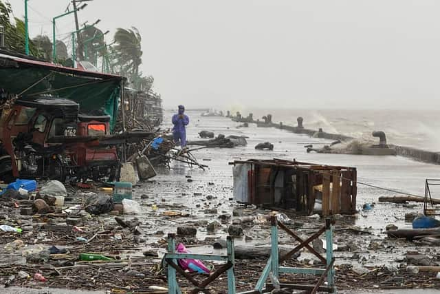
Typhoon Ragasa, the most powerful storm recorded this year, is passing through the Phillipines.
The superstorm with recorded winds of 270km/h has made landfall over sparsely populated northern islands on Monday (22 September), with tens of thousands being evacuated as a result. The Philippine weather bureau described the typhoon as bringing with it a “high risk of life-threatening storm surge”, with peak wave heights of over 3 metres.
Ragasa, which has been labelled “potentially catastrophic”, could trigger widespread flooding, landslides, and major damage to homes and infrastructure across affected regions, officials said. The storm, which is equivalent to a category 5 hurricane, is then expected to move towards Hong Kong, with all passenger flights being suspended for 36 hours starting Tuesday evening.
Australian Airline Qantas Airways has already updated its website with the closures and Cathay Pacific, Hong Kong’s flag carrier, has announced that 500 flights will be cancelled. The storm will hit Hong Kong on Tuesday and then move into southern China's Guangdong province.

Guangdong province in China raised its wind emergency response to Level II, the second-highest in a four-tier warning system, on Monday, while schools in the cities of Zhuhai and Jiangmen will be suspended from Tuesday, the China Daily reported. The storm was expected to have a severe impact in Guangdong until Thursday, the newspaper said, citing the provincial meteorological observatory.
Residents in Hong Kong rushed to supermarkets today to stock up on food and essentials. Authorities in Hong Kong have also announced school closures on Tuesday and Wednesday.
The government has stepped up preparations, recalling the devastation caused by Typhoon Hato in 2017 and Typhoon Mangkhut in 2018. In Hong Kong, the typhoon is expected to bring flooding and landslides.