Weather UK: Potential for early spring 'heatwave' to hit UK as Met Office forecasts 'drier interlude' with 'above average' temperatures

and live on Freeview channel 276
An early spring ‘heatwave’ could be on the cards for the UK as temperatures for late March and early April are expected to be several degrees above average. In its long-range forecast the Met Office predicts that there will be a “drier interlude” towards the end of March with “the risk of any more notably cold conditions developing looking very low.”
Looking towards April, the forecaster said “pressure is likely to be higher than average to the north of the UK” and northern areas will “tend to be drier compared to normal. It adds that “temperatures will probably be near average or slightly above overall, with any cooler interludes most likely in the north.”
Advertisement
Hide AdAdvertisement
Hide AdWeather forecasting models are pushing temperatures for late March and early April several degrees above average. According to GB News, Jim Dale, meteorologist for British Weather Services, said: “The potential is now there for a very mild spring, and I would expect to see some decent temperatures, potentially 19C or 20C before the end of March. But it is really during April that the warmer weather is likely to set in, and for this time of year we could even be looking at ‘heatwave’ conditions.”
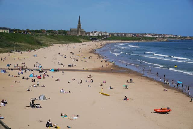

Mr Dale added: “I am a believer of a balancing effect in the weather, so I would now be expecting to see high-pressure build as we go through spring. This would mean milder temperatures into summer.”
Figures show temperatures around the UK coast to be slightly higher compared to the previous five years. The Brighton coast is around 9.2C, compared to 8.1C in March last year, and 8.8C the year before. Plymouth is at 10.2C compared to 9.5C last year, while Southend-on-Sea is at 7.8C up around a degree on last March.
For this weekend the Met Office expects the weather to be dry and cool to begin with but rain will “arrive from the west”. Today (Saturday 16 March) “cloud and rain will quickly move into western areas” which will then move “north and eastwards through the day.” Tomorrow (Sunday 17 March) the forecaster says it will be “a wet start for eastern areas with rain slow to clear, elsewhere drier with some sunny spells and the odd shower.”
Comment Guidelines
National World encourages reader discussion on our stories. User feedback, insights and back-and-forth exchanges add a rich layer of context to reporting. Please review our Community Guidelines before commenting.